
ROMEO – get started!
Only a few weeks to go, then ROMEO (ROmanian Methane Emissions from Oil & gas) will start! ROMEO is a large measurement campaign where we will combine a bottom-up and top-down quantification of the Romanian emissions from oil and gas and by this contribute to a better knowledge of these emissions, leading to more accurate budgets, which we urgently need if we want the Paris Agreement to succeed and reduction policies to be effective (Nisbet et al. 2019).
During the ROMEO campaign 12 research teams will be in the field to measure CH4 as well as other atmospheric compounds and meteorological data. We will use several different instruments, which are placed in two aircrafts from Scientific Aviation and INCAS, but also on drones, and in cars.
As you can imagine, such large campaigns – abroad and with more than 50 participants – are very intense. Not only during your time being there, but also now in the final preparation phase. Since the idea was born to bundle our knowledge and efforts for a joint campaign in Romania – which was already a year ago – we are busy with the detailed planning of it. This includes searching for the most promising but also practically doable areas, background research about expected CH4 emissions, the availability of facilities, driving and flight conditions and requirements, or the shipping of material. We are in contact with local and national authorities to ensure required permissions, and think about how to organise the daily work and collaboration between the ground and the aircraft teams. And certainly, we have to plan beyond the campaign, think about data storage and availability, as well as publication of results. As for MEMO2, all data will be collected in the ICOS Data Carbon Portal, a repository to ensure the availability of data for the whole team during and after the campaign.
We have 3 weeks in Romania to measure. This is a narrow time frame for the campaign, so it is essential to already now decide who is responsible, who is doing what and when. It is of great help, that the campaign is co-organised in close collaboration with our local colleagues from three Romanian research institutes, the National Institute for Aerospace Research “Elie Carafoli” (INCAS), the National Institute of research and development for optoelectronics (INOE), and the Babeș-Bolyai University in Cluj-Napoca. These local partners have better knowledge about local environmental conditions, rules, and pitfalls which we want to avoid. And local partners can also help identifying opportunities and scientifically interesting locations to measure CH4.
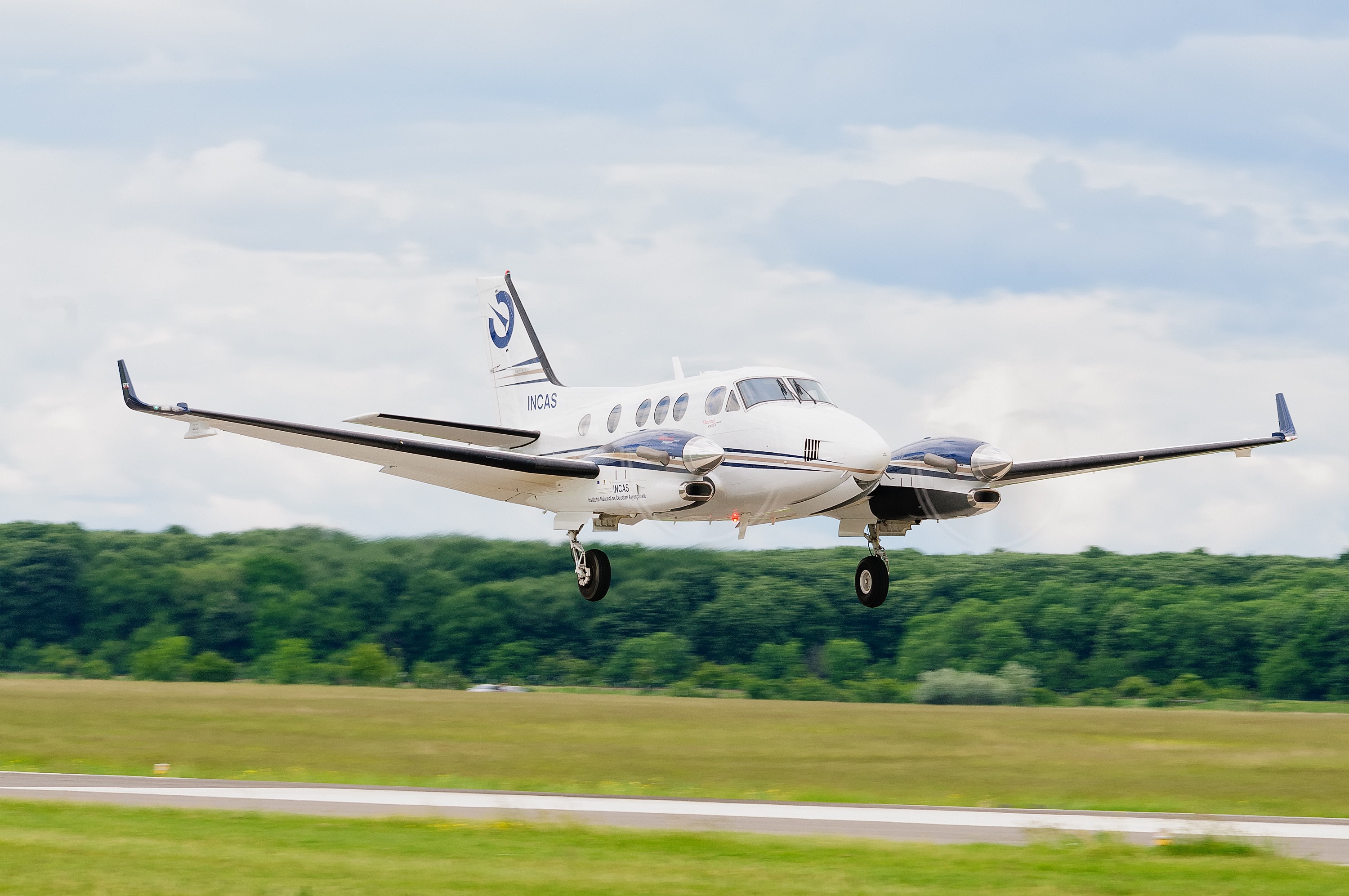
Our main contact and co-organiser in Romania is INCAS, the leading research establishment in aerospace science in Romania. In 2011, INCAS set up the research infrastructure ATMOSLAB (Fig. 1, left side) to develop a new research direction focussed on environmental airborne measurements.
 |
 |
|
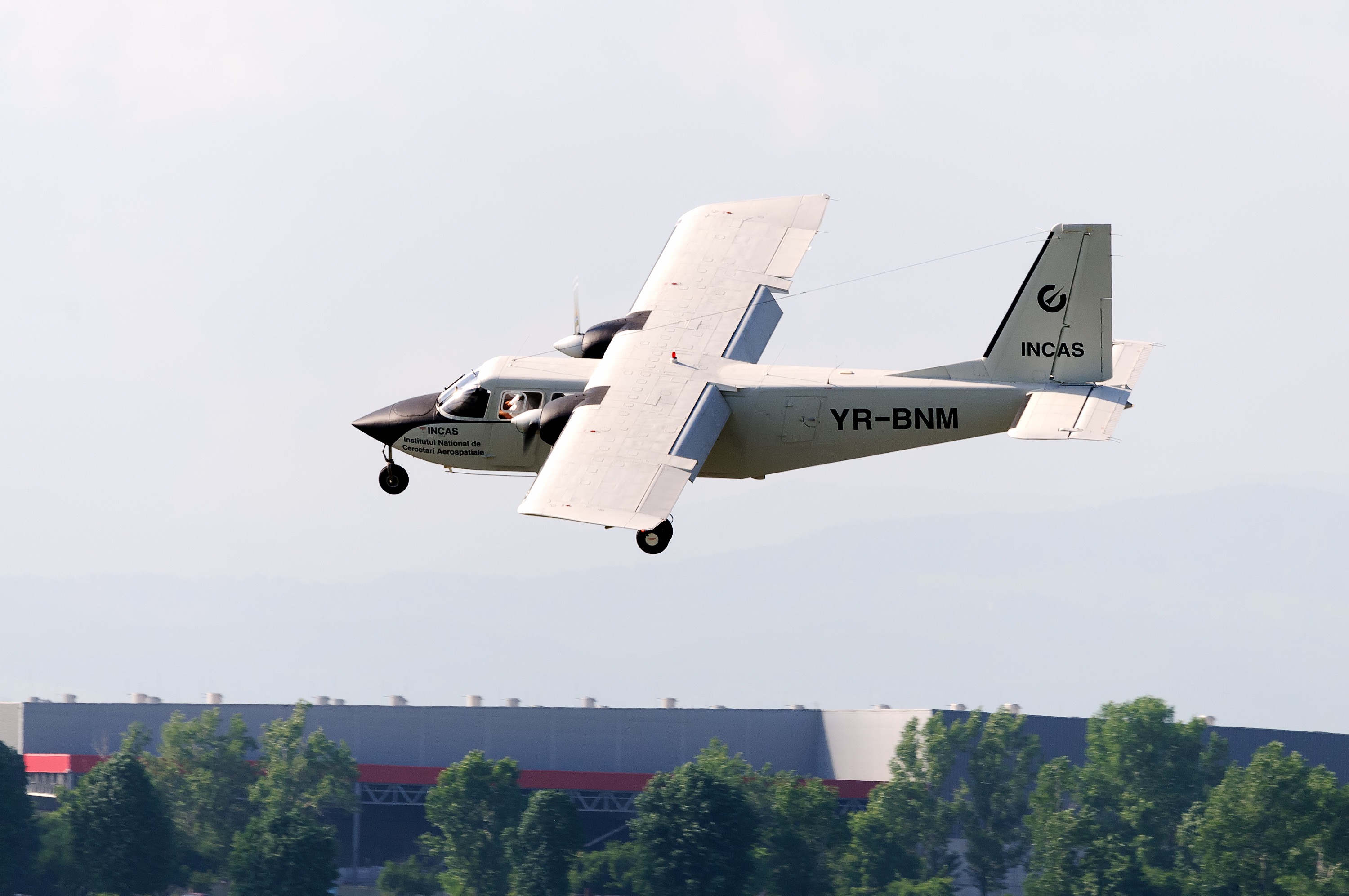
Fig.1: Two airborne platforms of ATMOSLAB-INCAS: left side – ATMOSLAB airborne platform based on Hawker Beechcraft King Air C90-GTx aircraft (Photo credit: Liviu Niculescu); right side – BN2 airborne platform Britten Norman Islander aircraft (Photo credit: INCAS) |
|
ATMOSLAB is based on a Hawker aircraft, equipped with i.a. in situ instrumentation for cloud and aerosol microphysics, 3D and 2D cloud particle imaging, and an airborne topographic laser scanning system. Three years later, ATMOSLAB was recognized as a national interest infrastructure (HG 786/10.09.2014) and the technological research capacities were extended by an experimental base for flight operations (BECA, Fig. 2, left side).
 |
 |
|
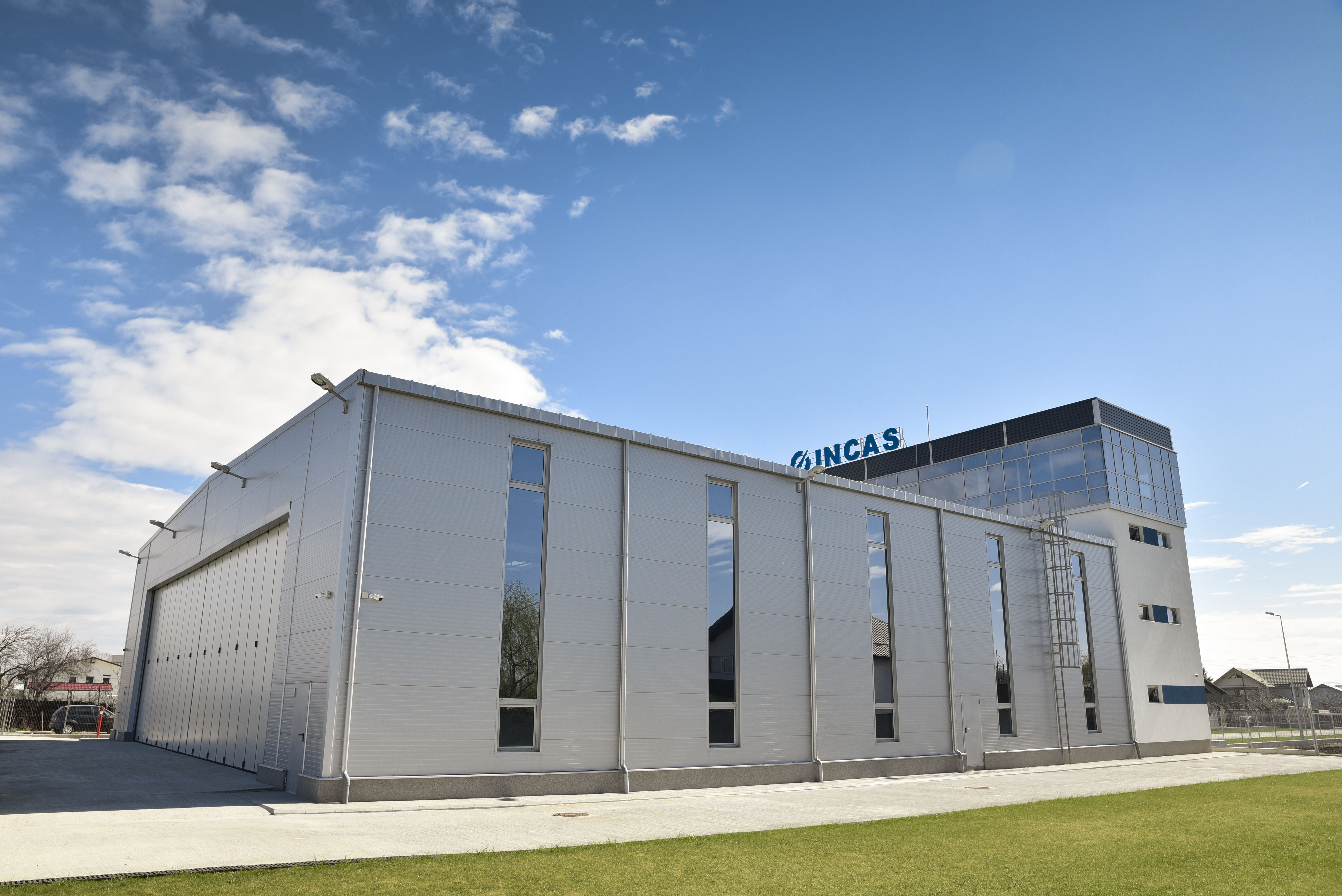
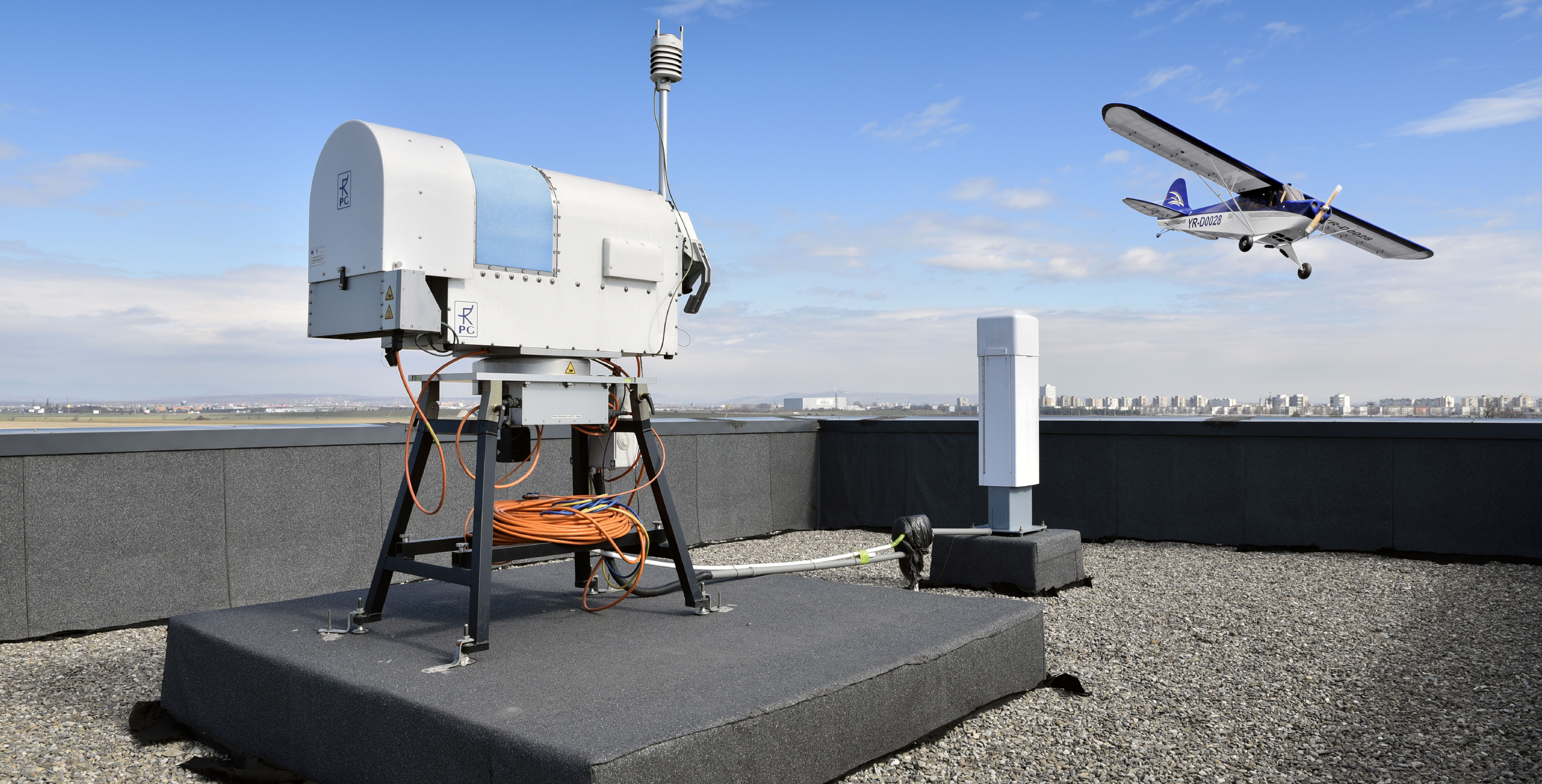
Fig.2: left side – BECA base (Strejnicu, Prahova county) (Photo credit: INCAS); right side – remote sensing instrumentation and UAV Clipped Wing Cub ARF 60% flying (Photo credit: INCAS) |
|
BECA is located in the vicinity of Strejnicu Airfield and includes a technical hangar and several research laboratories, e.g. for air quality and pollution, land and atmospheric modelling, or remote sensing. Among the experimental capabilities, the base is aligned to aviation standards and serves as control and navigation centre for flight research mission, such as ROMEO. Next to this, INCAS is also operating two Britten Norman Islander BN-2A 27 airborne platforms (Fig. 1, right side), one equipped with in situ and remote sensing instrumentation for aerosol and trace gases monitoring (CO, CO2, CH4, H2CO, NO2, SO2, water vapours), and the second in process for integration of AESA synthetic aperture radar for SAR applications, traffic monitoring, etc. INCAS is also operating a large drone with a maximum research payload of 70 kg for remote sensing instrumentation (Fig. 2, right side) and other smaller UAVs. This just as a brief overview about INCAS as our local organizer in Romania.
To get a clear idea about the local facilities and ensure a proper planning a close collaboration and communication is necessary. It also helps, to visit the place of interest in advance, discuss in detail and face to face. As a lot of rules and permissions need to be followed and applied for, it is also beneficial to directly talk to the national ministries and local authorities. Therefore, Thomas Röckmann as the coordinator of ROMEO went twice to Romania and visited not only INCAS and its facilities, but also talked together with Andreea Calcan (INCAS) to the environmental minister in Bucharest, Ms Grațiela Gavrilescu. They showed the scientific objectives of ROMEO as an international campaign and discussed possible support. Especially solid and independent background information about the envisaged areas is needed to decide about the final sampling areas and strategies.
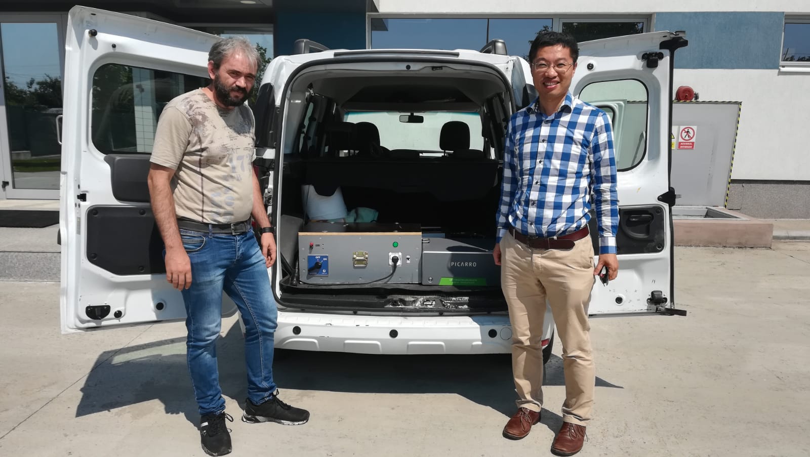
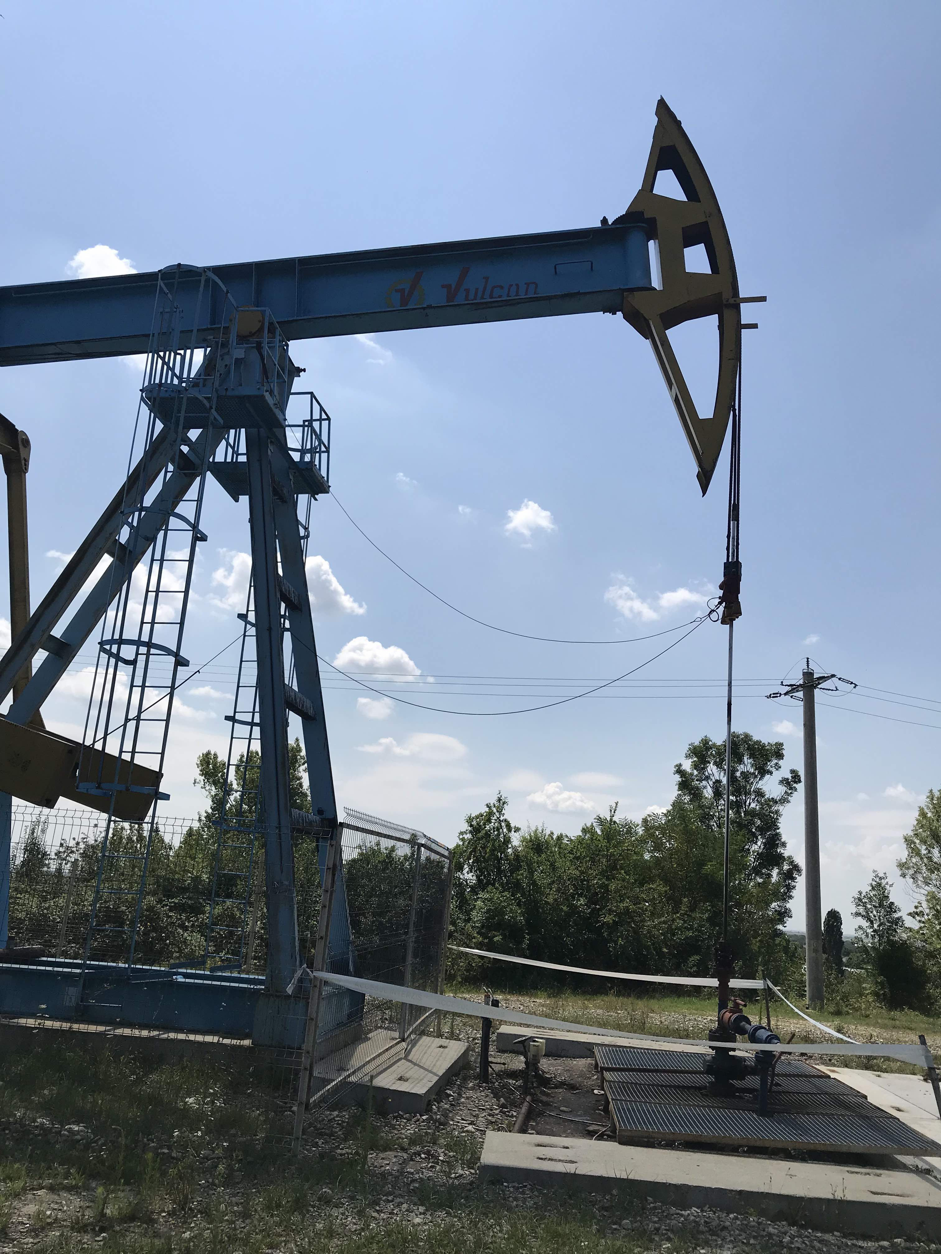
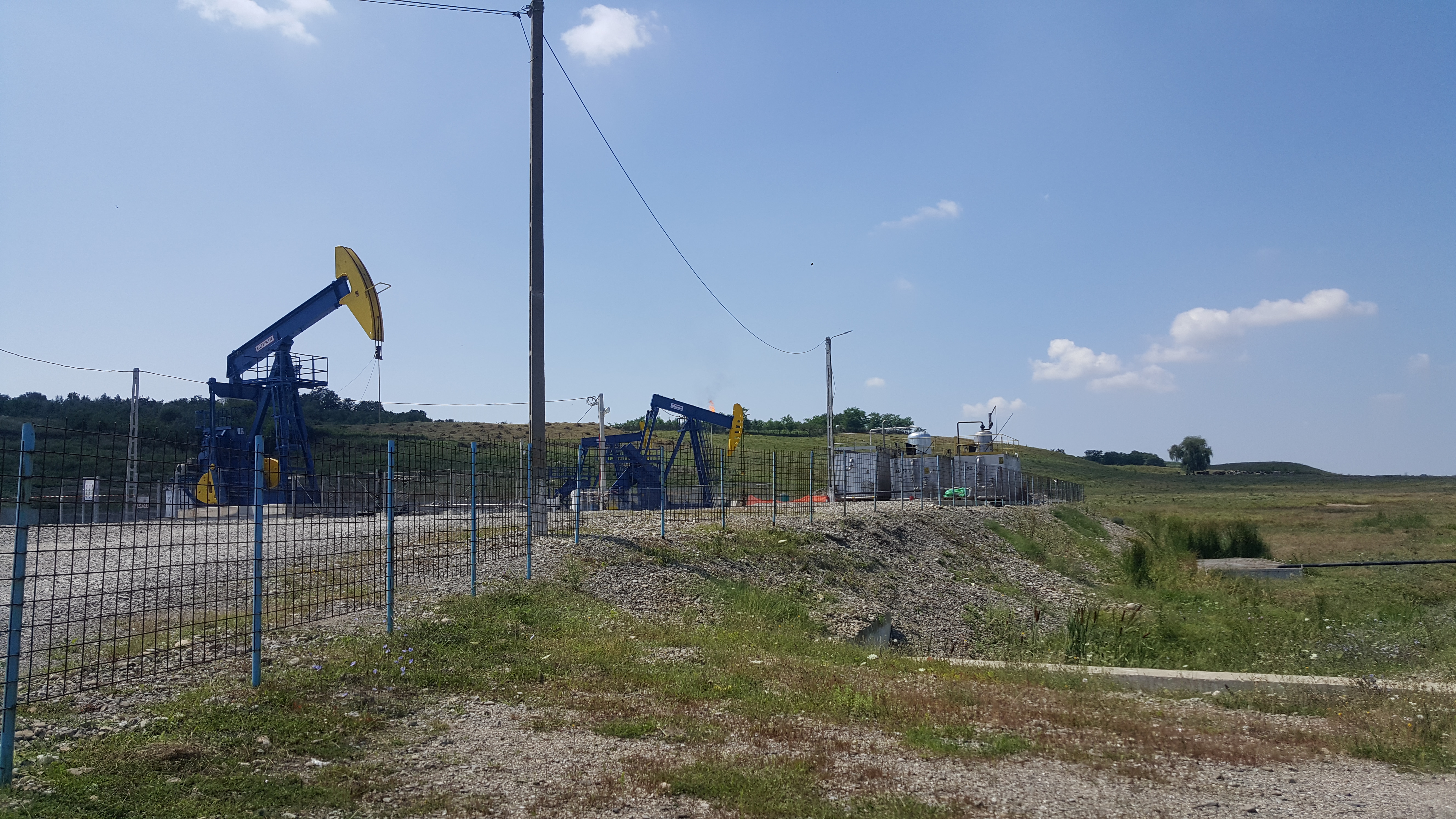
In July also Huilin Chen from the University of Groningen in the Netherlands, who will lead one of the two ground teams, visited INCAS for some days (Fig. 3). The purpose of his trip was to practically prepare for ROMEO and discuss the deployment of ground-based methane measurement facilities, i.e. mobile vans and unmanned aircraft systems. Furthermore, he and the colleagues from INCAS made a first survey to parts of the city of Bucharest and also to some oil production fields nearby.
|
 |
|
Fig.3: left side above – Marius Corbu (INCAS) and Huilin Chen (University of Groningen, NL) in front of a mobile van equipped with a Picarro analyser to measure atmospheric CH4; left side below and right side – Oil extraction facilities visited for preparing the experimental part of the ROMEO ground-based campaign (Photos credit: INCAS) |
|
Huilin and Marius measured CH4 by using a mobile van to get a better impression about concentrations which could be expected during the campaign. Those information is needed to prepare the instrumentation. Beside the instrument preparation itself, the pre-campaigns are also important to get an idea about e.g. road conditions to develop a realistic measurement strategy. Imagine that driving abroad can be very challenging with e.g. unexpected road conditions, but also unexpected driving behaviours. Roads might be unpaved, or not wide enough for big vans. We also prefer roads circling the sites envisaged to ensure an optimal sampling. Those aspects need to be implemented in the planning, i.e. where and when to measure, to decide how many kilometres per day to drive and to develop alternatives in advance.
 |
|
|
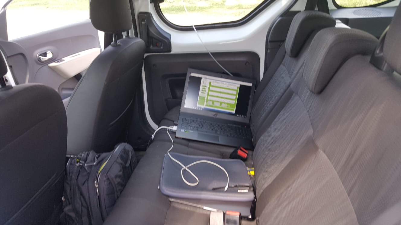
Fig.4: A laptop in the back of the car communicates with a Picarro analyser to display online atmospheric CH4 measurements |
|
So the detailed planning and fine tuning of ROMEO will keep us busy the next weeks until we can start measurements in Romania. We are looking forward to it and will keep you updated!
The ROMEO team